Saturday, May 17, 2014

Bone Beach!


Salton Sea!  I can't help but post again about this place... I LOVE IT!   Today, it's about Salton Sea State Recreational Area located in Imperial County USA.   It's located on the east shore of the lake off of Route 111 (near Salvation Mountain and the Mud Volcanoes).  What makes this beach so UNIQUE and AMAZING is that not make of your typical "sand".  The sand is literally millions pulverized dead fish bones and gills.  The Salton Sea is literally an accident that occurred in 1905 by a flood when waters of the Colorado River overflowed into the area.  The lake was initially fresh water, however over time the salinity gradually increased.   Fish die off regularly... making an interesting.   The beach is softer than what one might imagine.  It's not a place one would sun bath and most certainly NOT swim (the water apparently quite toxic),  but definitely worth a visit if you are in the area! It's difficult to express what draws me to this place..  it smells (often), everything is old and everything dying (even the lake).   But it's beautiful scenery, it's amazing history, it's unique geology, it's artistic population and it's fish skeleton beach..  seriously,  who couldn't love this place????


Mud Volcanoes!


Geothermal Mud Volcanoes are located on the east side of the Salton Sea near Niland, CA.  They are located across an expanse of dried clay about the size of a football field.  They  range in size from a few inches to over 8 feet.  The vent opening also range in size from 1/2 inch to about a foot in diameter.   The volcanos bubble (128 degrees), burp, and spit mud frequently. They make a unusual sounds :).  The mud oozes down the side of the volcanoes and then dries, allowing the volcano to grow even larger. The United States Geological Survey scientists estimate them to be about 16,000 year old!  I believe the property to be privately owned, however it is not fenced and multiple tourists visit the site daily. 


Friday, May 16, 2014

No diving!


This an amazing hotel with a even  more amazing pool is the Marina Bay Sands located in Singapore.  It was developed the by the Las Vegas Sands and it's the WORLD'S most expensive building at an estimated 5.7 billion US dollars (including land costs).  The hotel has three 55 story towers with 2,561 luxury rooms and suites.  The Sky Park is located on the top floor with 360 degree views of Singapore, restaurants, gardens, a gorgeous infinity pool and the world's largest public cantilever observation deck.  The lower levels are home to amazing high end shops, a roller skating rink, many theaters and a water canal allowing for gondola rides.


Kisses


Almost a bit too perfect to seem real :).  These are the Chocolate Hills in the Bohol Province of Philippines.  There are as many as 1,779 hills spread within a 20 square mile area.   The hills are covered with grasses and ferns, and the valleys are filled with rice and other crops.  In the winter,  the bright green hills turn brown, hence their name, Chocolate Hills.  Today, it is a popular tourist attraction in the area and is a hopeful for consideration as a World Heritage Site.  The cone shaped hills are of similar shapes and sizes.  The limestone hills are about 98 to 164 feet high. The unique land formations were formed ages ago by the uplift of coral deposits and the action of rain water and erosion.  The grassy hills were once coral reefs that erupted from the sea in a massive geological shift. Wind and water put on the finishing touches over hundreds of thousands of years.
Legends tell another story of how these hills were formed.  The first story was of two giants who during a feud tossed large boulders, rocks and sand at each other.  The two giants became exhausted, forgot about their fight, became friends and failed to clean up their messy mounds. Another tells a sort of Arogo the Giant who was young and powerful.  Arogo fell in love with Aloya, however Aloya was a simple mortal. When Aloya died,  Arogos couldn't stop crying.  When his tears dried, the hills were formed. The next legend tells a story of a town being terrorized by the Giant Carabao. Carabao ate all of their corps.  The townsfolk placed spoiled food out for the giant to eat and he did.  His stomach became quite ill and he defecated large mounds of feces.  When they dried,  the Chocolate Hills were formed. The last is about a Giant name Miguel who ate everything in his path.   One day he witnessed a beauty girl on the plain and wanted to win her affection.  He was a bit overweight, so he excreted everything he ate.  Like the last Giant,  his fecal matter created the Hills, but he did win Adrianna's love.  I prefer the to visualize chocolate over dried mounds of poop.
 
=


Thursday, May 15, 2014

Medusa of the Arctic


The answer is YES,  in the event that you have ever pondered the  question, "Do trees grow north of the Arctic Circle?"  A few trees do survive including the Spruce and Pine.  Some grow naturally and are indigenous to the area while others are planted by residents.   However, the further north you go above the circle, trees become less dense, sparse and small until there is nothing left by open tundra and the Arctic Ocean.  In most of the arctic circle the ground is  frozen beneath the top layer of soil (permafrost), so trees can't set roots down far enough to prevent from falling over.   Trees have little hope as  harsh bitter winds carry sharp crystals that cut and kill trees as well.  And, there's pretty much no sun half the year.  More or less,  the Arctic Circle is the end of trees.  Those that do survive sure make beautiful photo opportunities. The arctic circle wasn't always a field of tundra,  it was once a dense forest with trees that rose around 120 feet.  Today, some of these trees have been found.   They are not petrified wood or coal,  but still preserved as wood and leaves.   Note the trees by the sign below :).


Tuesday, May 13, 2014

Greener than Green!


This is the place to be if you love horses, blue skies and green grass. Inner Mongolia is an autonomous region of the People's Republic of China located in the northern part of the country. The area isn't all grasslands of course, but it's most famous for it's beautiful green pastures. Approximately 73% of Inner Mongolia actually is grasslands.  Hohhot, Xilamuren and Huitengxile are three of the area's largest grasslands. These regions provide pasture for sheep, goats, cattle, and the famous Mongolian horses and Bactrian camels. Sheep and goats (roughly in equal proportions) are by far the most important and the most numerous of the animals raised on the grasslands. I'm not sure I need to write more.... Dreamy, right?


Wat's Rong Wif Dis?????


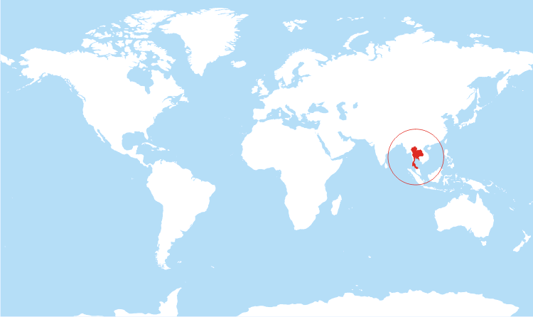
Wat Rong?  EVERYTHING :) is wonderfully wrong about this temple.  This is the Wat Rong Khun  (วัดร่องขุ่น)  or in English, The White Temple.   The temple is located in the Chiang Rai Province of Thailand near the town of Mueang Chiang Rai.   This Buddhist temple was built in1997 by the artist Chalermachai Kositipat.  It is a major tourist attraction in Northern Thailand.  On May 5, 2014, the temple suffered major damage in the Mae Lao earthquake.  Kositipat reports he will dedicate the rest of his life to restoring the temple to it's original beauty.  I found an interesting description online by a visitor to the temple, "If a savant on suicide watch could throw up the contents of his mind,  I reckon this would be the result."
ajor tourist attraction in Northern Thailand.  On May 5, 2014, the temple suffered major damage in the Mae Lao earthquake.  Kositipat reports he will dedicate the rest of his life to restoring the temple to it's original beauty.  The interior is also quite unique as you will find murials depicting the 911 incident,  Freddy Kruger, The Terminator, Michael Jackson, Avatar characters, Elvis, Harry Potter, the Kungfu Pand Transformers, Neo from Matrix and more.  You will also find a beautifully adorned Buddhist altar in traditional style.   I suppose it is for one to interpret themselves once inside (or by viewing the photos)here.


Monday, May 12, 2014

Not a Canyon!


Bryce Canyon is located within Bryce Canyon National Park of southwestern Utah, USA.  However Bryce Canyon is a collection of giant amphitheaters shaped features along the Paunsaugunt Plateau not an actual canyon.   Frost weathering, stream erosion or lake bed and river sedimentary rock created the canyon's unique geological structures called "hoodoos". The Canyon area was settled by Mormon pioneers in the 1850s and was named after Ebenezer Bryce.  Ebenezer homesteaded the area in 1874.  In was later designated as a National Park in 1928 with 35,835 acres of land.  It receives minimal visitors (compared to other national parks) due to it's remote location.  There appears to be plenty of thing to do and see at Bryce Canyon.  I say.. LOVELY!


No mans Island!


Okinotoro Islands (distant bird island) are about 1977 acres of uninhabited land, however most of the actual 'dry' land is made of 4 concrete encasing (previously 6 as two were lost to erosion).   It has a platform structure located within it's lagoon area that houses a research station.  This island is VERY remote.. it appears to be over 1000 miles from any real chunk of land.  Technically, the "islands" are not islands under UN Law of the Sea as they cannot sustain human life or economic life.  Therefor,  no country can claim this land as their exclusive economic zone.  Because of this law,  it is deemed that Japan cannot claim the area, as it does now.  In 1925, a Japanese Navy ship investigated the area and confirmed that no other country had claimed the reefs.  The Japenese then declared it their territory and placed it under their jurisdiction.  Between 1939 and 1941 a foundation was completed for a lighthouse and a meteorological observation area , however WWII halted it's construction.  In the years of 1987 and 1994, the government of Japan  built steel breakwaters and concrete walls surrounding the area to stop erosion.   In 1988, The Japan Marine Science and Technology Center built a marine investigation facility which they continue to maintain.  Betweent 2005 and 2007, a lighthouse beacon , radar system and a repaired heliport were installed. Talks today continue about building a power station.  Japan has spent over 600 million on upkeep of the atoll.  They've even planted additional coral to help in it's protection.  The waters surrounding the reefs are potentially rich in oil and other resources.  It is also strategically located for military significance.   At hight tide the dry area is no greater than a small bedroom, in low tide it is double that size.  The "atoll (not island) is always at risk for typhoons.  Japan currently claims over 154,000 square miles around Okinotorishima, but the People's Republic of China dispute this claim.  They state the atoll is only rocks (not an island) and cannot be claimed.   China hasn't made a claim on the atoll, but it's definitely a topic of debate.  China does not want to claim this tiny island.  Japan has gone to great lengths to possess these tiny islets  as it allows Japan to claim and extra 150,000 square miles of exclusive economic zones, strategically located between Taiwan and US military bases.